


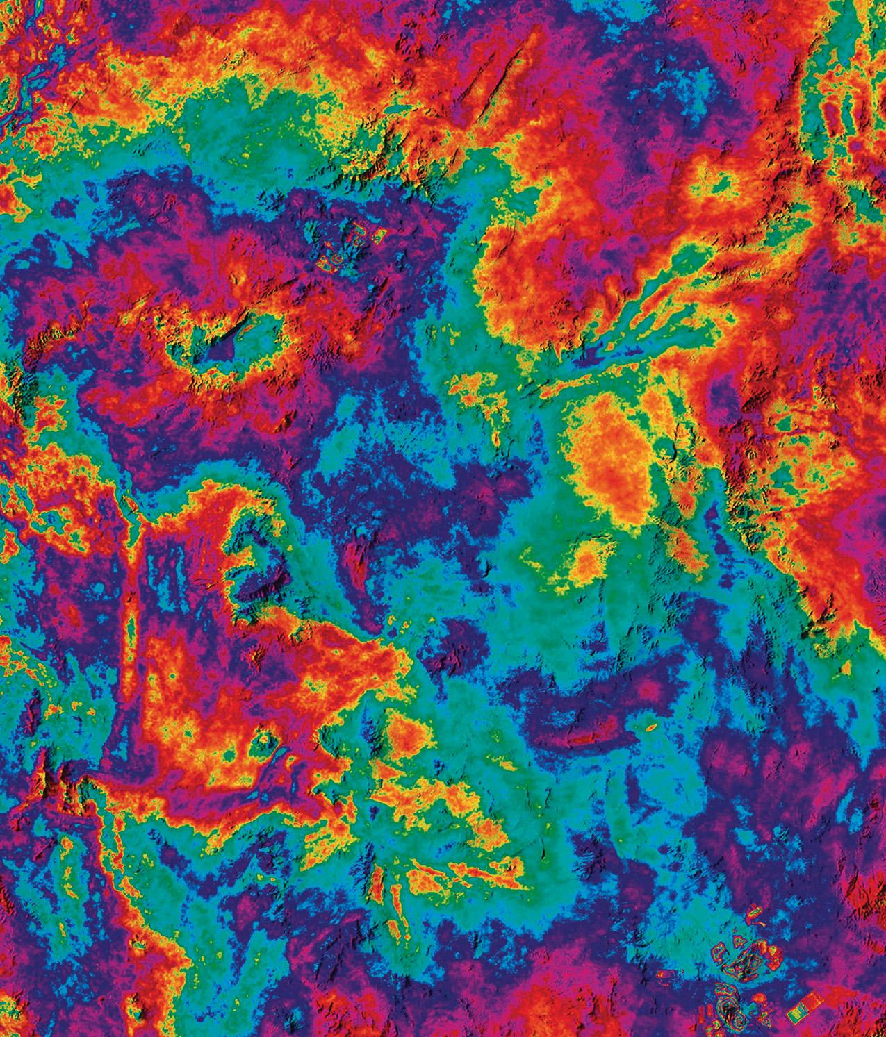
Beyond what appears to be a landscape splotched with tie-dye, this image marks a turning point in ultraprecise Earth mapping.
It was taken by the European Space Agency’s (ESA) Copernicus Sentinel-1C satellite, which launched in December 2024. Using radar, the satellite can map Earth’s surface down to the millimetre, whatever the weather. To do this, it takes two or more images of the same location on different days to record both the amplitude and phase information (the strength and location) of the radar pulse that’s reflected back.
On 20 January and 1 February, Sentinel-1C captured the data that made this image of northern Chile, where the Atacama Desert meets the Pacific Ocean. In the b...
You're reading a preview of
BBC Science Focus (Digital) - 1 Issue, March 2025